Built for cities & teams
Tree Mapping for Municipalities – Urban Forest Inventory & Management
City-wide tree inventory, team collaboration, compliance reporting, and public data. Built for parks departments, urban forestry, and public works. Groundzy Teams is available.
Scale from single coordinators to crews with shared maps and dashboards.
- Team workspaces & admin controls
- Compliance-ready exports
- GZ-TIN on every municipal tree
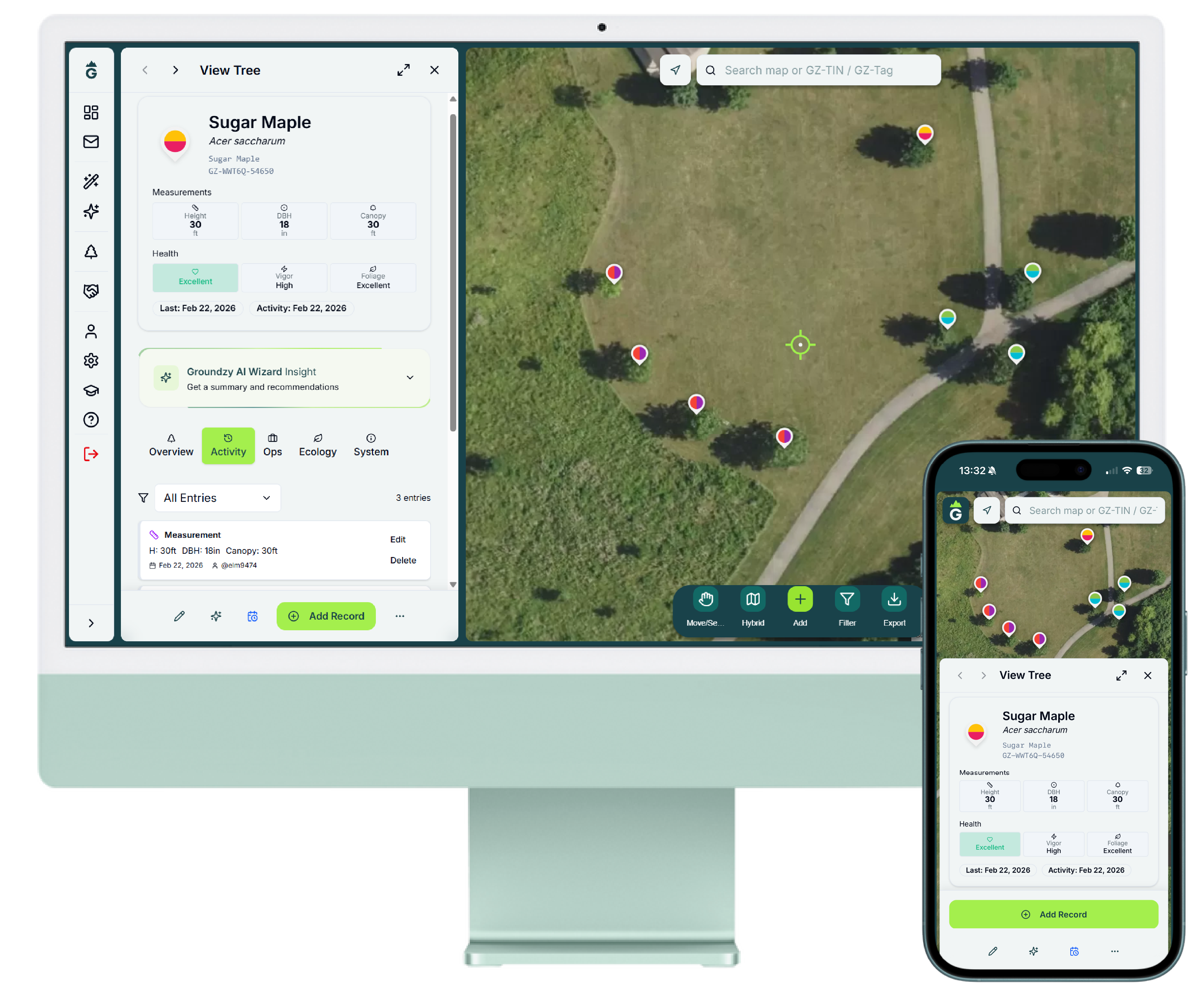
Synchronize forestry, ROW, parks, and public works on one atlas
Groundzy Teams extends city GIS with lineage every regulator expects: repeatable species confirmations, perpetual IDs (GZ-TIN), department-wide history, dashboards for seasonal crews.
Field verification that scales with planting programs
Use AI-guided photo checkpoints for volunteers and contractors documenting ROW, schools, conservation land, ensuring everyone references the correct species and cultivar claims.


Unlimited inventories without losing parcel context
Layer parks, corridors, cemeteries, utility easements—each specimen ties to parcels, councils, mitigation sites, planting cohorts without fragmenting spreadsheets.
Keep crews, coordinators, contractors aligned
Give forestry, arboriculture vendors, interns, GIS analysts, grants staff the same authoritative map—with admin tooling, dashboards, accountability trails.
Compliance & council-ready packets
Bundle grant tables, ADA ROW clearance logs, emerald ash borer timelines, biomass totals—straight from GIS—with GZ-TIN references regulators expect.
Pilot Groundzy Teams with your forestry unit
Review pricing tiers, onboard a departmental workspace, map a borough or district as proof.
Why Municipalities Choose Groundzy
Municipalities manage thousands of trees across parks, streets, and public property. Urban forest inventory, compliance reporting, and team coordination require a scalable platform. Groundzy Teams offers 10–50+ users, team dashboards, admin controls, dedicated account management, and advanced analytics for city-wide tree management.
Today, individual staff can use Groundzy Pro for tree mapping, AI species identification, unlimited export, and GZ-TIN tracking. Contact us to learn about Teams pricing and early access for your department.
Frequently Asked Questions
Is Groundzy Teams available for municipalities?
Groundzy Teams is available now. It offers 10–50 users, team dashboards, admin controls, dedicated account management, and advanced analytics for city-wide tree management.
How many users can use Groundzy Teams?
Groundzy Teams supports 10–50 users for parks departments, urban forestry, and public works crews. Contact us for enterprise options beyond 50 users.
How do I get pricing for municipalities?
Contact us at support@groundzy.com with subject 'Groundzy Teams for Municipality.' We offer custom pricing and early access for parks, forestry, and public works departments.
What Our Users Say
"Groundzy helped me understand my trees' health like never before. The AI Wizard makes it easy to know when my trees need attention—no more guessing."
Juan M.
Homeowner · Groundzy Home
"Groundzy helps us seamlessly manage everything from residential clients to large properties with hundreds of trees. It's an essential tool for our team."
Sam C.
Just for Trees, Inc. · Groundzy Teams
"Groundzy gives me a clear, reliable way to assess tree health and keep accurate records. It's become an essential tool in my professional workflow."
Luis M.
ISA Certified Arborist IL-9856A · Groundzy Pro
Plan Your Urban Forest Inventory
Groundzy Teams for municipalities. Contact us for custom pricing.
Sign Up10–50 users • Dedicated account management • Enterprise features